
Scenic Cruising
The Strait of Magellan is one of the world's most legendary maritime passages — a 350-mile waterway separating mainland South America from Tierra del Fuego. Discovered by Ferdinand Magellan in 1520, this protected route between the Atlantic and Pacific Oceans shaped five centuries of maritime history. Today, cruise ships transit the strait for its dramatic scenery, Magellanic penguin colonies, and the thrill of following in the wake of history's greatest explorers.
Captain's Logbook
Booking guidance: This is a scenic cruising passage — there are no shore excursions to book. Your ship handles everything. The best preparation is knowing which side of the ship to stand on and when, dressing for Patagonian wind, and bringing binoculars. If your itinerary includes a stop at Punta Arenas mid-transit, see our Punta Arenas port guide for excursion options there.
Sailing Through the Strait of Magellan
I stood on the upper deck as we entered the Primera Angostura, the First Narrows, and the wind hit me so hard I had to grab the railing with both hands. The Patagonian gusts came in sharp bursts — cold, dry, tasting of dust and open grassland. To starboard, Tierra del Fuego stretched flat and gold-brown under a sky so enormous it seemed to press down on the land. To port, the mainland looked almost identical — two halves of a world split apart by this ribbon of dark water. I could see the current moving beneath us, swirling where the channel narrowed to barely a mile and a half. Our ship slowed, and for a moment the only sound was wind against steel.
A pod of Commerson's dolphins appeared off the bow — small, black and white, leaping in pairs through our wake. I watched them for ten minutes, my eyes watering from the cold. A retired couple from Cornwall stood beside me, the husband narrating facts from a paperback history of Magellan's voyage, the wife ignoring him entirely and photographing the dolphins with a concentration that bordered on reverence. I liked them both immediately. He told me that Magellan named this ocean "Pacific" because after the violence of the strait, the open water beyond seemed impossibly calm. I looked at the dark churning channel beneath our hull and tried to imagine emerging into calm after weeks of this, and I felt something tighten in my throat.
Later that afternoon, as we passed the Isla Magdalena penguin colony, I borrowed binoculars from a fellow passenger and counted rows of Magellanic penguins lined along the hillside like tiny sentries. The smell of guano reached us even from the ship. Tens of thousands of birds stood in the wind on that bare island, raising their chicks in sand burrows, and it struck me that these penguins had been doing exactly this for thousands of years before Magellan ever entered the strait — before Europe knew this waterway existed, before ships carried spices and dreams through its narrows. The penguins did not care about the passage of history above their heads. They just stood in the wind and endured.
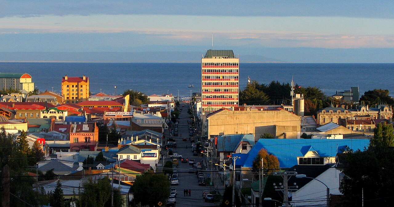
By evening, we could see the lights of Punta Arenas glowing against the mountain backdrop, and I understood something I had not grasped from maps alone: this strait is not just water between land masses. It is a corridor through time itself. Magellan spent thirty-eight days lost in these channels. We crossed in hours. I felt both grateful and humbled by the difference. As the western channels opened before us — narrower now, mountains rising on both sides, glacial ice visible in the higher valleys — the ship fell quiet. Most passengers had gone inside for dinner, but a handful of us remained on deck, wrapped in every layer we owned, watching the light die over the most remote water we had ever sailed.
The moment that changed something in me came near midnight. I had gone back on deck alone, unable to sleep, and the strait was dark except for the ship's running lights and a sky full of stars so bright they looked wet. The Southern Cross hung low over Tierra del Fuego. There was no sound but the hull cutting water and the wind — always the wind — and I stood at the railing and felt something I can only describe as smallness. Not the diminishing kind. The clarifying kind. I was one person on one ship in one narrow channel at the bottom of the world, and the water beneath me had carried Magellan and Darwin and a thousand sailors whose names nobody recorded, and it would carry ships long after I was gone. The stars did not care about my itinerary. The wind did not care about my schedule. The strait simply was — ancient and indifferent and beautiful — and standing in it I felt the strange relief of being reminded that the world does not revolve around me. It was, paradoxically, one of the most comforting moments of my life.
Looking back, I realized that what I had expected from the strait — scenic cruising, historical interest, a line on the map checked off — was not what it gave me. It gave me wind and silence and the strange weight of following in the wake of explorers who did not know what waited beyond the next headland. I learned that some passages are not about the destination on either end but about what shifts inside you while you are between them. The strait taught me patience. It taught me that the journey itself can be the point. Sometimes you have to travel through the narrow places to understand how wide the world really is. I have sailed the Caribbean and the Mediterranean and the fjords of Norway, and none of them moved me the way this cold, gray, windswept channel did — not because it was more beautiful, but because it asked more of me. The Strait of Magellan does not give itself easily. You earn it in cold hands and watering eyes and hours of standing in the wind. And what you earn stays with you.
The Passage — What to Expect Onboard
The Strait of Magellan is a scenic cruising passage, not a traditional port call — your ship does not dock, and you do not disembark (unless your itinerary includes a separate stop at Punta Arenas). The transit typically takes 24-36 hours from the Atlantic entrance near Cape Virgenes to the Pacific outlet west of Desolation Island. Some itineraries transit only a portion of the strait, stopping at Punta Arenas mid-passage.
Deck access: Most cruise lines open the upper observation decks during the transit. The best viewing is from the forward observation lounge or the top open deck. Port side (left) faces the South American mainland; starboard (right) faces Tierra del Fuego. Both sides offer dramatic scenery, so move between them. The narrowest point — Primera Angostura — is the most dramatic moment; your captain will usually announce it.
Bridge viewing: Some ships offer bridge viewing during the transit. Check with guest services early in the day — spots are limited and fill quickly. The bridge offers the best forward views and the chance to hear the captain and officers narrate the passage.
What to bring on deck: Dress in your warmest layers — windproof outer shell is essential, not optional. Temperatures range from 2-12 degrees C (35-55 F) depending on season, and wind chill drops it further. Bring binoculars for wildlife spotting (penguins, dolphins, sea lions). A camera with a good zoom lens captures shore details. Bring hand warmers if you have them. Budget $0 for this passage — it is included in your cruise fare.
Navigating the Transit
Timing: Ships typically enter the strait in the early morning or late evening. If entering from the Atlantic (eastbound to westbound), watch for the Punta Dungeness lighthouse marking the entrance. If your transit begins overnight, set an alarm — the Primera Angostura passage is worth waking up for.
Duration by section: The Atlantic entrance to Primera Angostura takes roughly 2-3 hours. Primera Angostura to Punta Arenas is another 4-6 hours. Punta Arenas to the western channels is 8-12 hours, and the western channels to the Pacific exit are the most scenic — allow 6-10 hours. Total transit varies with speed and weather.
Onboard activities: Most ships schedule a naturalist or historian lecture during the transit. The library and observation lounges are popular gathering spots. Hot drinks from the buffet are your best friend — carry a to-go cup on deck. Some ships set up hot chocolate stations on the observation deck during scenic passages.
Cell service and internet: There is no cell service through most of the strait. Ship satellite internet works but may be slower than usual due to the southern latitude. Download any maps, books, or content you want before entering the strait. This is a good day to disconnect.
What to Watch For
Booking guidance: Ship excursion options provide guaranteed return to port and are worth considering for first-time visitors. For those who prefer to explore independently, local operators often offer competitive rates — book ahead during peak season to secure your preferred times. Whether you choose a ship excursion or go independent, confirm departure times and meeting points before heading out.
Booking guidance: There are no shore excursions during a scenic passage — this is all from the ship. The best investment is a good pair of binoculars (or borrow from the ship's excursion desk if they offer loaners). If your ship stops at Punta Arenas during the transit, see our Punta Arenas guide for penguin tours ($40-50), Fuerte Bulnes ($15-20), and city exploration.
Primera Angostura (First Narrows)
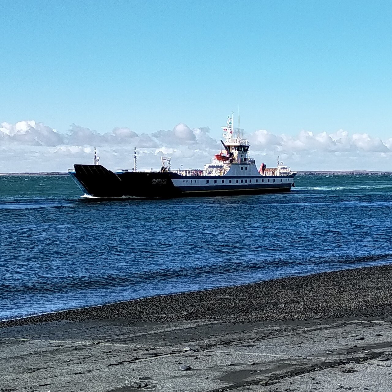
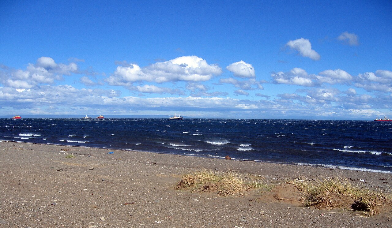
The most dramatic moment of the transit. The channel narrows to just 1.5 miles wide with strong tidal currents visible from deck. Watch for Commerson's dolphins — small black-and-white dolphins that ride the bow wave through the narrows. The Punta Dungeness lighthouse on the Atlantic side dates to 1899. Ships slow considerably here and the captain usually makes an announcement. This is the best single moment for photography.
Isla Magdalena Penguin Colony
If your ship passes within viewing distance of Isla Magdalena (many do), you can see the penguin colony from the ship with binoculars. Over 100,000 Magellanic penguins breed on this island from October to March. The hillside appears to move as thousands of birds waddle between burrows and the shoreline. If your itinerary includes a Punta Arenas stop, boat tours to the island cost about $40-50 USD per person and take 4-5 hours round trip.
Western Channels and Glaciers
The western portion of the strait splits into a maze of channels between mountainous islands. This is the most visually dramatic section — snow-capped peaks, glacial ice visible in high valleys, dense southern beech forests clinging to steep slopes. Dawson Island, the largest island in the strait, appears to starboard. Watch for condors soaring on thermals above the ridgelines. The scenery here rivals the Chilean Fjords passage further north.
Wildlife Throughout
Beyond penguins and Commerson's dolphins, watch for South American sea lions hauled out on rocky shores, Peale's dolphins in the western channels, giant petrels and black-browed albatross gliding alongside the ship, and — if you are very lucky — orca or humpback whale sightings in the deeper sections. The strait is a rich feeding ground, and binoculars pointed at any stretch of shoreline will usually reveal something alive.
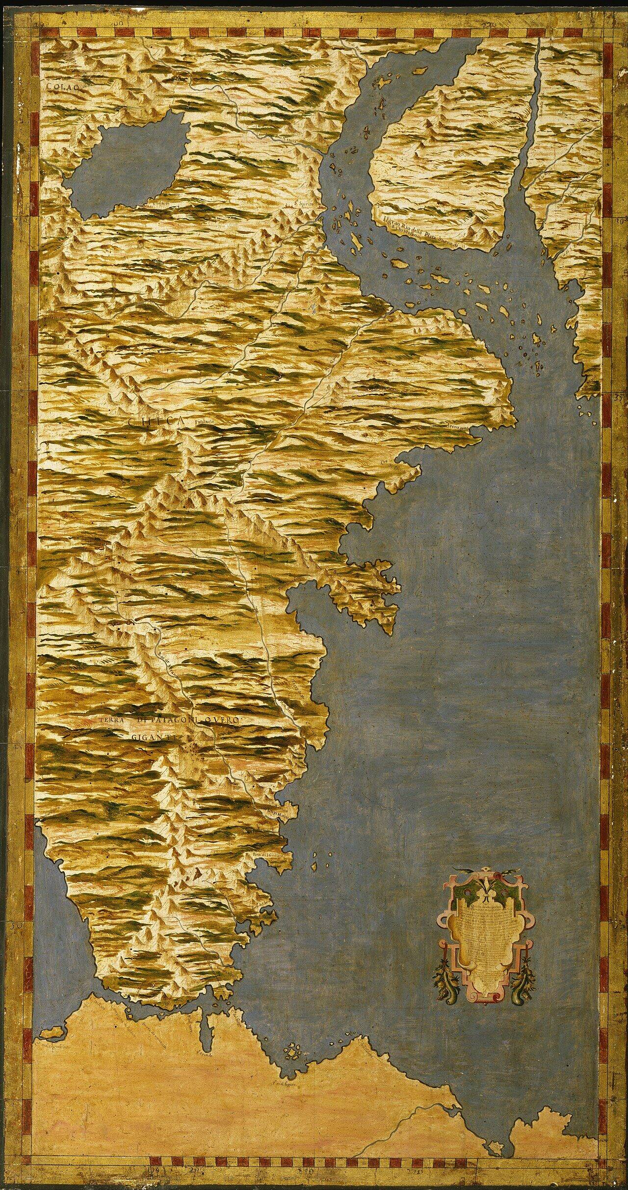
Strait of Magellan Map
Weather & Best Time to Visit
The Passage
The Strait of Magellan offers varied scenery across its 350-mile length:
- Atlantic entrance — Wide opening between Cape Virgenes (Argentina) and Punta Dungeness
- Primera Angostura — First Narrows, just 1.5 miles wide, strong tidal currents
- Segunda Angostura — Second Narrows, slightly wider
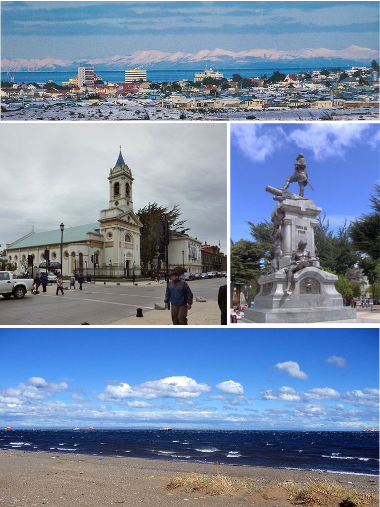
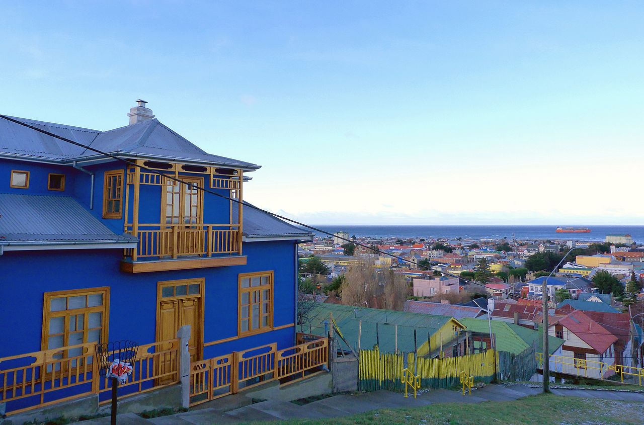
- Punta Arenas — Largest city on the strait, common port call
- Western channels — Maze of islands, dramatic mountains, glaciers visible
- Pacific exit — Multiple outlets between islands; Desolation Island marks the western end
Wildlife
- Magellanic penguins — Massive colonies at Isla Magdalena and Isla Marta
- South American sea lions — Haul out on rocks throughout the strait
- Commerson's dolphins — Black and white dolphins endemic to southern waters
- Andean condors — Soar on thermals above the strait
- Seabirds — Cormorants, giant petrels, albatross in western sections
- Whales — Occasional humpback and orca sightings
Scenic Highlights
- Isla Magdalena — Penguin reserve, accessible by Zodiac or ferry from Punta Arenas
- Dawson Island — Largest island in the strait, dramatic scenery
- Western fjords — Glaciers and peaks rivaling Chilean Fjords
- Tierra del Fuego — "Land of Fire" — named for indigenous peoples' campfires
- Historic lighthouses — Punta Dungeness and others mark the passage
Depth Soundings
Practical notes for the passage — you will not leave the ship, but preparation matters.
Clothing: This is the single most important preparation for the strait. Wear a windproof outer layer, warm base layers, a wool hat, and gloves. Even in summer, wind chill on the open deck drops temperatures to near freezing. Jeans and a fleece are not enough. If you do not own proper windproof gear, check whether your ship's shop carries any before the transit — some expedition-focused lines stock jackets for about $50-80.
Timing: Ask guest services the night before for the transit schedule — what time the ship enters the strait, when it reaches Primera Angostura, and when it passes Punta Arenas. Set alarms for key moments. The most dramatic scenery often happens at dawn or in the late afternoon light. Missing Primera Angostura because you slept in is a genuine regret.
Photography: The light in the strait is extraordinary but challenging — overcast skies, glare off the water, and fast-moving subjects (dolphins, birds). Use a fast shutter speed (1/1000 or faster for wildlife). A polarizing filter cuts water glare. Protect your camera from salt spray with a clear plastic bag or rain cover. Phone cameras work for landscapes but struggle with distant wildlife — borrow or bring binoculars and shoot through them if needed.
Seasickness: The strait is generally calmer than open ocean, but the narrow sections can have strong currents and chop, especially at Primera Angostura. If you are prone to motion sickness, take medication before the transit begins, not after symptoms start. The western channels are typically calmer than the eastern narrows.
Budget: The transit costs you nothing beyond your cruise fare — budget $0 for the passage itself. If your ship stops at Punta Arenas, budget $30-80 per person for a comfortable day ashore including transport, lunch, and entry fees. Penguin tours add about $40-50 per person.
Practical Information
- Length — 350 miles (570 km) from Atlantic to Pacific
- Transit time — 24-36 hours depending on route and conditions
- Key port — Punta Arenas, Chile, is the major city on the strait
- Weather — Notoriously changeable; strong winds (williwaws) common
- Best viewing — Deck time throughout; bridge viewing if available
- Season — Year-round navigation; Southern Hemisphere summer (Nov-Mar) offers best conditions
Photo Gallery


Frequently Asked Questions
Why is the Strait of Magellan historically significant?
Ferdinand Magellan discovered this passage in 1520 during the first circumnavigation of Earth. For centuries it provided the only protected route between the Atlantic and Pacific, avoiding the treacherous Cape Horn. The Panama Canal eventually reduced its commercial importance, but the strait remains a vital shipping lane for vessels too large for the canal.
How long does it take to transit the Strait of Magellan?
A full transit takes approximately 24-36 hours depending on weather, currents, and vessel speed. The strait is 350 miles long, with the narrowest section (Primera Angostura) just 1.5 miles wide. Ships often stop at Punta Arenas mid-transit.
Is the Strait of Magellan rough?
Generally calmer than the open ocean around Cape Horn. However, the strait can experience sudden squalls and "williwaws" — violent downdrafts from the mountains. The narrow sections have strong tidal currents. Overall, it's a protected passage.