New Plymouth is the rare one. It sits on New Zealand's west coast, roughly halfway down the North Island, in the shadow of a near-perfect volcanic cone — and most cruise itineraries sail straight past. The urban area holds about 60,200 people, the wider district about 90,100, and its port, Port Taranaki, is the only deep-water port on the country's entire western seaboard. For a cruise traveller it is a small, unhurried, local call in a country whose better-known stops can feel rehearsed.
The mountain is the reason people come, and it deserves its full name. Taranaki Maunga rises 2,518 metres directly south of the city, and in January 2025 it became something almost no mountain on earth is: a legal person. That is not a metaphor. This guide covers how you get ashore (a shuttle, always — you cannot walk out of the port), what a day on the Coastal Walkway looks like, why the mountain may be invisible when you arrive, and the heavy history the Taranaki region carries.
Last reviewed: July 2026
Weather & Best Time to Visit
Captain's Logbook
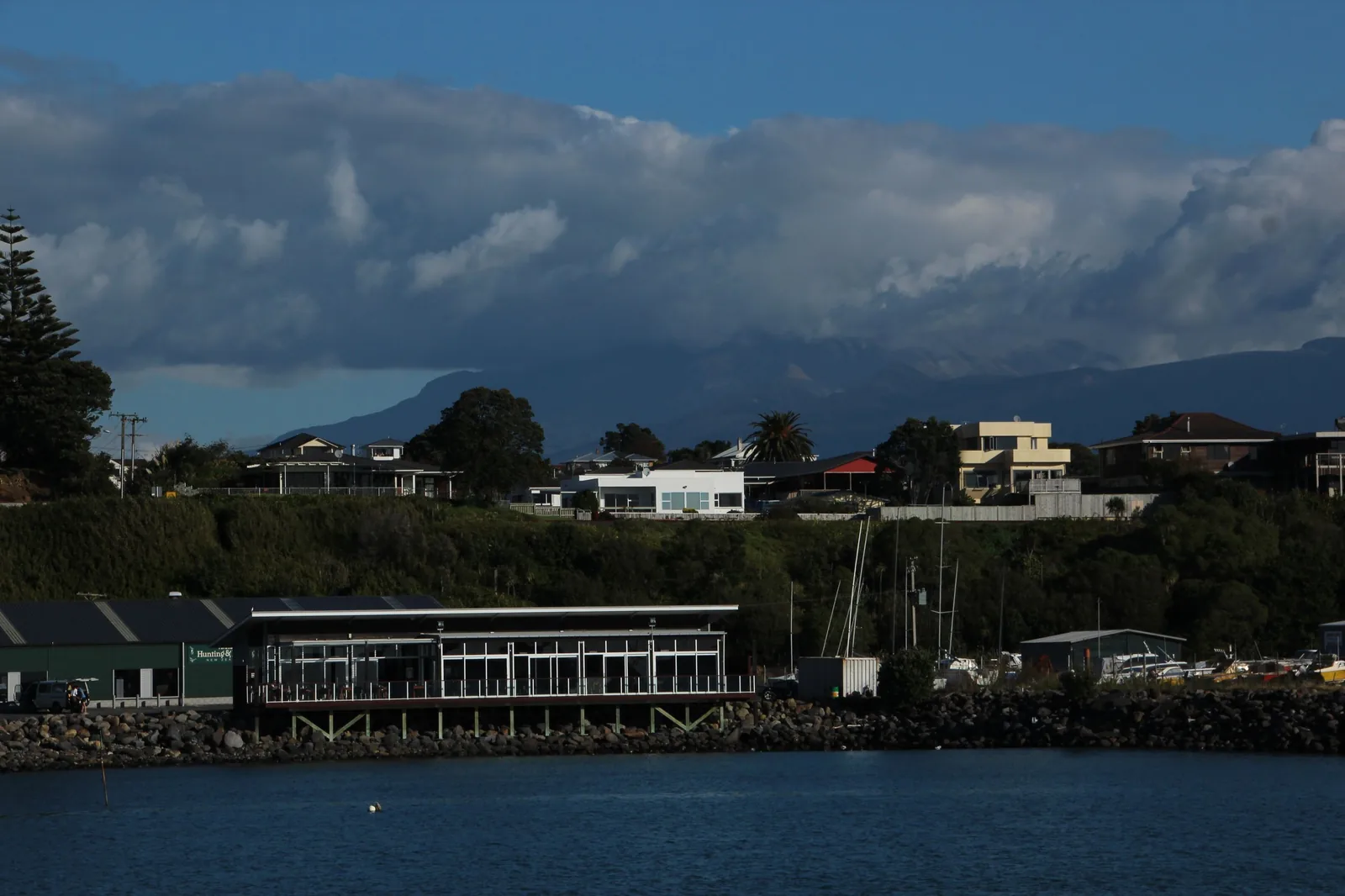
The honest version of the view: Taranaki Maunga is directly behind this cloud, and on many days that is exactly what you get. Photo: Takver, CC BY-SA 2.0 via Wikimedia Commons
An honest note before I begin: I have not stood on the New Plymouth foreshore. What follows is read from the record — from the port authority's own documents, from the Department of Conservation, from NIWA's climate data, from the legislation itself, and from people who have walked that seafront path. Soundings in another's wake, not my own footprints. When I sail here I will come back and log what I actually found.
Here is what strikes me first about New Plymouth, and it is a small, telling thing: you cannot walk off the ship. Port Taranaki is a working commercial harbour — bulk liquids, logs, LPG, project cargo, the offshore energy trade — and the New Zealand Cruise Association's port entry says it plainly: secure port, cannot walk off port. You are put on a shuttle and driven across the working apron to a gate. It is an unglamorous beginning, but I have come to think it is the most honest introduction the place could offer. This is not a town that built itself a cruise terminal and waited. It is a port that does actual work, and it lets you visit.
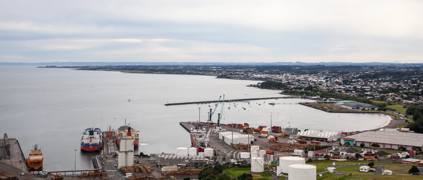
Port Taranaki from Paritūtū. This is a working harbour — bulk liquids, logs, LPG, the offshore trade — and the reason you leave it by shuttle rather than on foot. Photo: russellstreet, CC BY-SA 2.0 via Wikimedia Commons
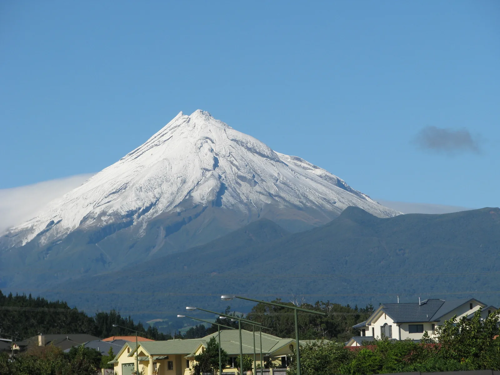
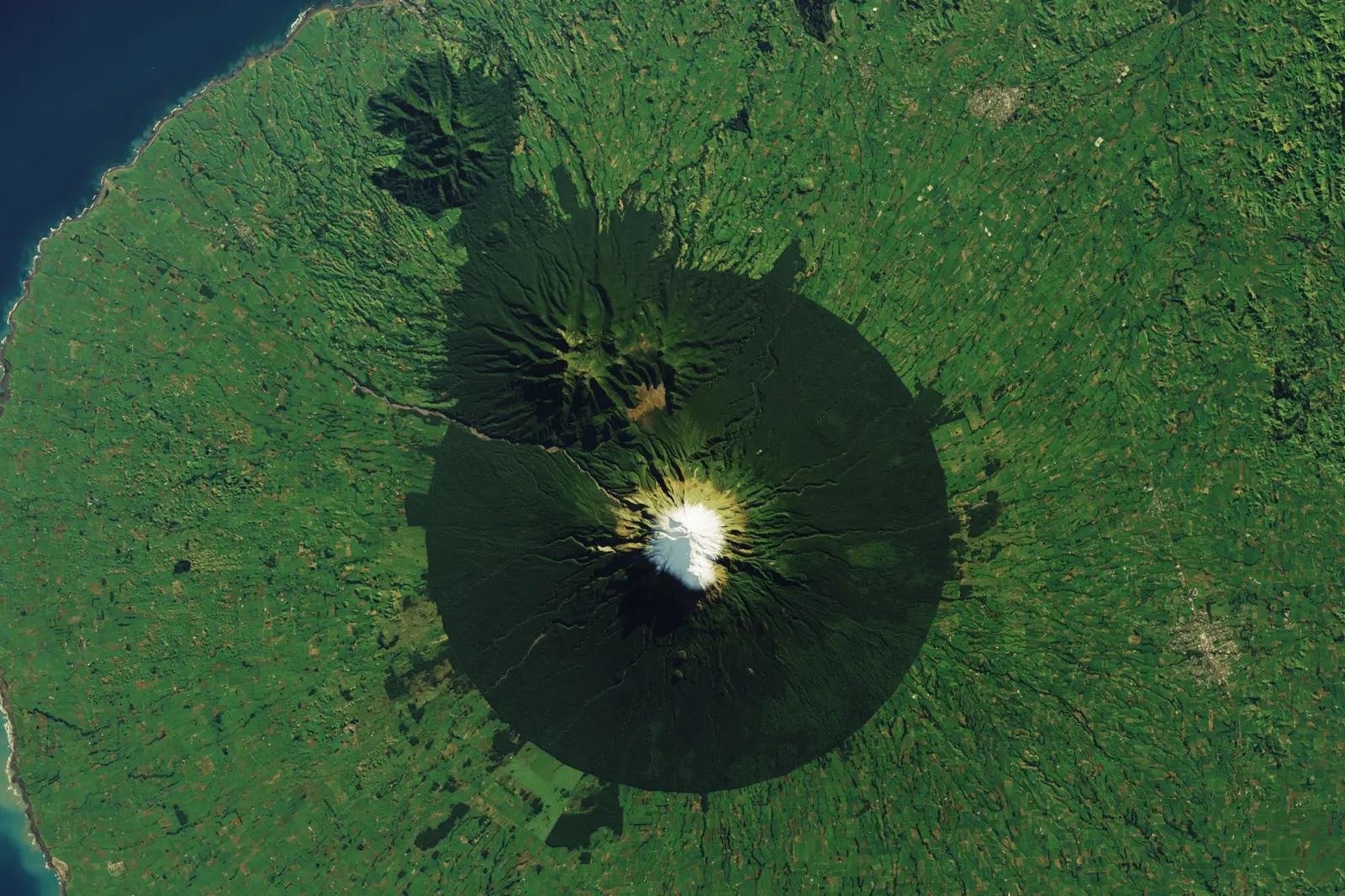
And then there is the mountain. Taranaki Maunga — and I want to use that name, because the name is the story — rises 2,518 metres almost perfectly conical, twenty-nine kilometres from the city. Egmont National Park is a near-circle around it, roughly ten kilometres in every direction from the summit, and in the aerial photographs the boundary is startling: I have looked at them and still cannot quite believe the line, dark forest inside it, green pasture pressed right up to the edge. It is the shape of a law drawn on the ground. The park has an official name again too, Te Papa-Kura-o-Taranaki, restored in April 2025.
The reason the boundary is startling: a 9.6 km radius drawn around the summit in 1881 and still legible from orbit. Dark forest inside the line, pasture to the edge. Landsat 8, June 2023. Photo: NASA Earth Observatory image by Wanmei Liang, using Landsat data from the U.S. Geological Survey, public domain via Wikimedia Commons
What happened in January 2025 is the thing I keep turning over. New Zealand passed Te Ture Whakatupua mō Te Kāhui Tupua — the Taranaki Maunga Collective Redress Act — and in doing so recognised the mountain and its surrounding peaks as Te Kāhui Tupua, a legal person, with the rights, powers, duties and liabilities of a person. It passed unanimously. It follows Te Urewera in 2014 and the Whanganui River in 2017, and it is not a piece of whimsy: it is the legal machinery of a Treaty settlement, giving effect to a deed signed with Ngā Iwi o Taranaki in 2023. The mountain now has a face and a voice, Te Tōpuni Kōkōrangi, half appointed by Taranaki iwi and half by the Crown.
You cannot understand why that matters without the harder history, and Taranaki's is very hard indeed. This is where the New Zealand Wars started, in 1860, over a land sale at Waitara that the paramount chief had no intention of making. New Plymouth was the epicentre — women and children evacuated to Nelson, three-quarters of the farmhouses in the surrounding settlements destroyed. It is part of why a town founded in 1841 does not feel as old as it is. The dates and the detail are in the history section below; what I want to put here is what they add up to.
What followed was worse and quieter: raupatu, confiscation, hundreds of thousands of acres taken from iwi deemed to be in rebellion. And then, on that confiscated ground, something remarkable — Parihaka, founded around 1866 by Te Whiti o Rongomai and Tohu Kākahi, whose resistance was deliberately, strategically nonviolent: ploughmen turning settlers' paddocks to assert title, fencers blocking surveyed roads. On 5 November 1881 some 1,600 armed troops entered the village at dawn and were met by children singing and skipping, and by residents offering them food. The Crown apologised in 2017, and the Attorney-General who delivered that apology at Parihaka called what happened here a shameful part of New Zealand's history.
So when I read that the mountain was given its name back and made a legal person in 2025, I do not read a novelty headline. I read the closing of an arc that opened at Waitara in 1860. I keep returning to the detail of that dawn at Parihaka — children sent out to meet armed men with singing, and food offered to soldiers who had come to destroy the village. There is a quiet grace in that which I do not think I could have managed, and which reads to me a great deal like a prayer made with the whole body. Looking back over everything the record taught me about this coast, what I realized is that Taranaki's real monument is not the cone on the skyline but the stubbornness of people who refused to answer violence in kind — and who were finally, a century and a half later, answered.
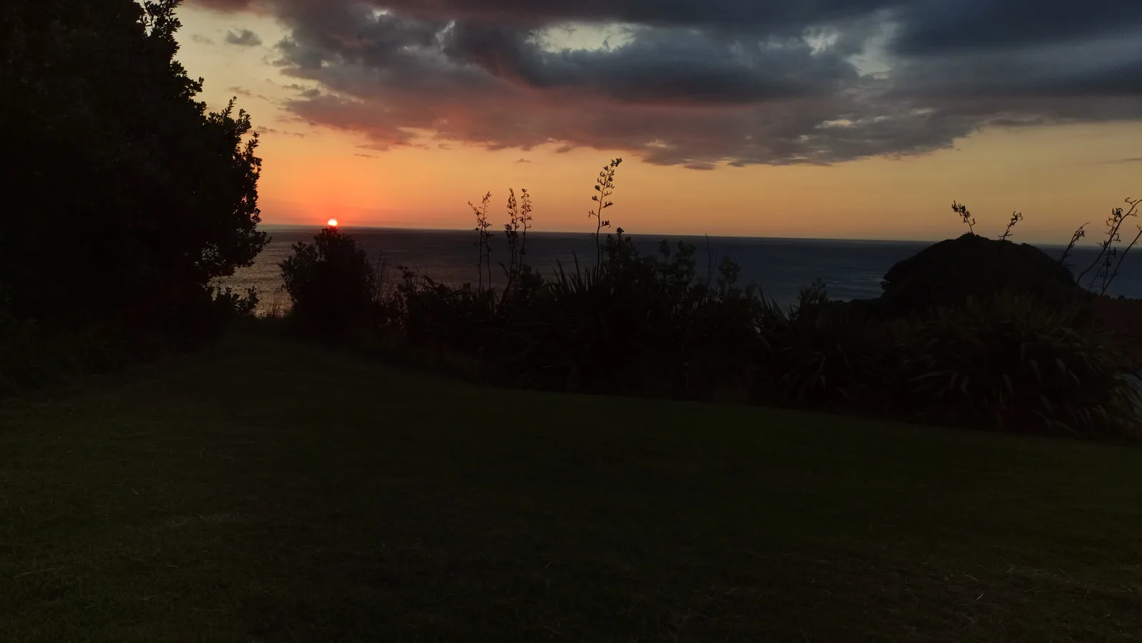
Sunset over New Plymouth. The arc that opened at Waitara in 1860 took a century and a half to close, and it closed here. Photo: L Maule, CC BY 4.0 via Wikimedia Commons
One thing from the record I want to see with my own eyes: Te Rewa Rewa Bridge, at the eastern end of the Coastal Walkway — a white steel arch of nineteen ribs over the Waiwhakaiho River, built with the agreement of Ngāti Tawhirikura hapū beside a burial ground, deliberately touching lightly on that bank out of respect, and deliberately aligned so that as you walk away from the graves the arch frames the mountain. A bridge built to point at what outlasts us. I find I have very little to add to that.
The thing I would tell you, then, until I can tell you from experience: do not come to New Plymouth for a checklist. Come for a long flat walk beside the sea with a volcano at your shoulder — though the cloud may well decide otherwise, and you should plan the day so that it does not matter. Go into Puke Ariki and read the Taranaki story properly while you are standing in it. Take the mountain seriously if you go up — different weather, different rules. And take the name seriously too. It is Taranaki Maunga, it is legally a person, and after everything that happened here, that is not a small thing to say out loud.
Cruise Port Guide
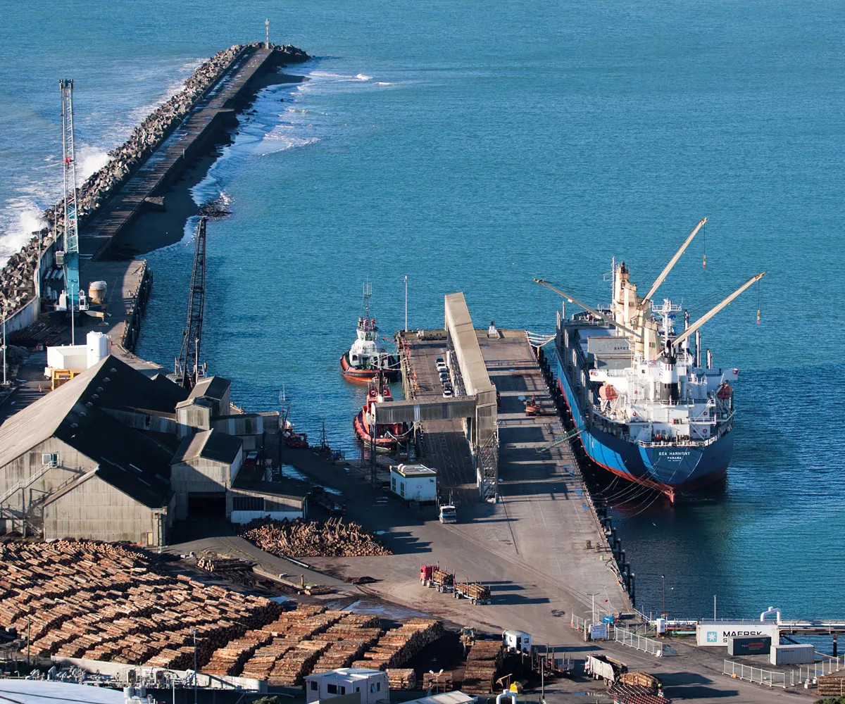
Port Taranaki from above: a bulk carrier alongside, tugs standing by, and the export log yard. Your ship berths at Blyde Wharf in this same basin — and this is as close to it as you will get on foot. Photo: Dave Young, CC BY 2.0 via Wikimedia Commons
Port Taranaki is a dock port — ships berth alongside, there is no tendering — but a working commercial harbour rather than a cruise facility. It is the only deep-water port on New Zealand's west coast, owned by the Taranaki Regional Council, handling over three million tonnes a year of bulk liquids, logs, LPG, petrochemical and farming freight across ten berths. Larger cruise ships have used the Main Breakwater berth; published berth dimensions vary between sources, so the berth for your ship is a question for your cruise line rather than this page.
The most important practical fact: passengers may not walk across the port. The New Zealand Cruise Association's own port entry states it flatly — secure port, cannot walk off port — so for safety you cross the working area by shuttle. Port Taranaki runs one to the East Gate; the cruise line's ground handler runs shuttles from there into the city, main stop Puke Ariki Landing beside the i-SITE. Transit is around five to seven minutes, and i-SITE staff are stationed at the port itself to help with bookings. Shuttle questions go to your ship's ground handling agent, not the port. If you would rather walk, ride out to the gates and walk the Coastal Walkway into town — about 3.4 km, roughly half an hour, flat the whole way.
Getting Around New Plymouth
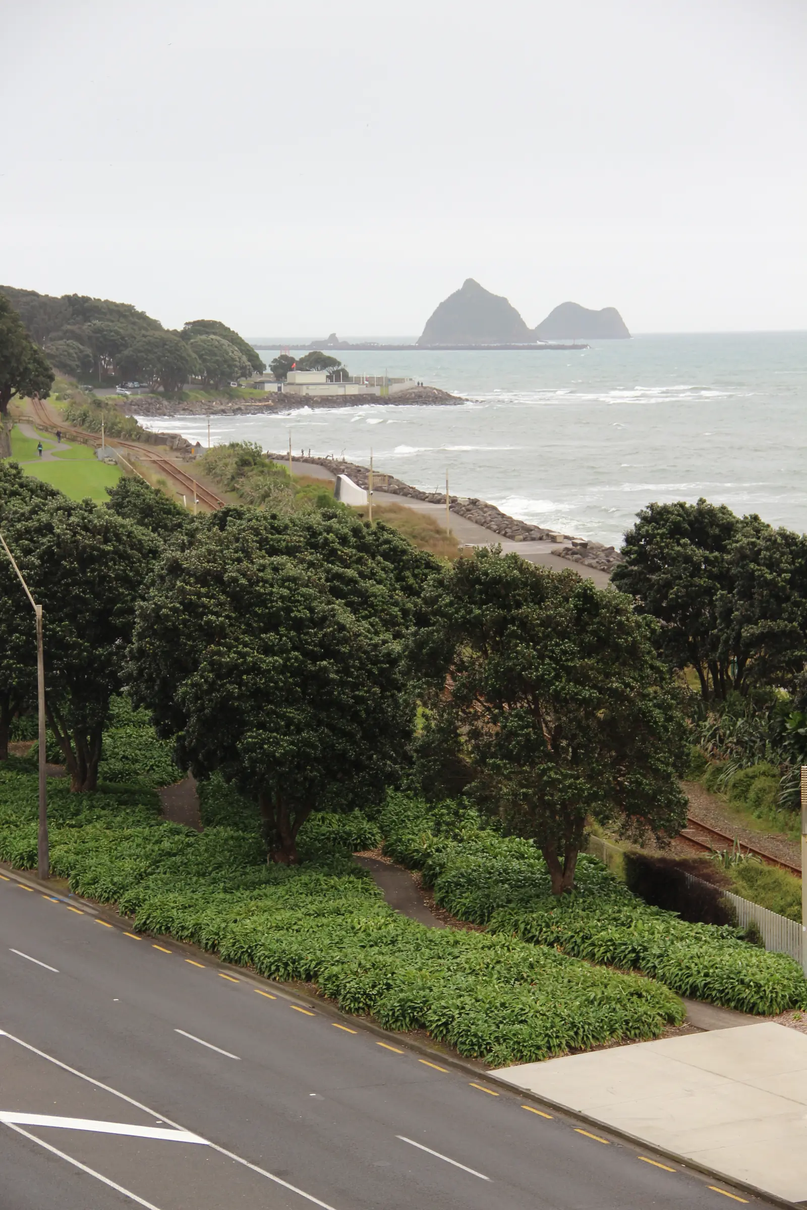
The Coastal Walkway at its western end, looking back toward the port breakwater and Ngā Motu. This is the stretch you walk if you get off the shuttle at the gates rather than riding into town. Photo: Rosalindaymes, CC BY-SA 4.0 via Wikimedia Commons
Once the shuttle drops you at Puke Ariki Landing, New Plymouth is a walking town and the walking is good. The Coastal Walkway runs 13.2 km along the seafront from Pioneer Park at Port Taranaki through the central city out to Bell Block Beach (a further 9.7 km on to Waitara is under construction, due about the end of 2027), sealed and shared between pedestrians and cyclists the whole way. You are unlikely to walk all of it and do not need to: the central stretch takes in the Wind Wand, the foreshore and the beaches, flat and impossible to get lost on.
For the two things beyond walking range you need wheels. Te Rewa Rewa Bridge sits at the Waiwhakaiho end of the walkway — a long walk or a short ride, and many visitors hire a bike for that reason. Egmont National Park is the bigger commitment: the North Egmont road end is 29 km from the city, about a thirty-minute drive, and Egmont Road climbs steeply through rainforest for its last six kilometres. On a typical 08:00–15:00 port call North Egmont is the realistic mountain option; Dawson Falls on the southern side is about an hour each way, a tight round trip.
One current caution: parking at the North Egmont road end is limited until December 2026 while a new visitor centre is built, the centre itself working from a temporary building and construction traffic on the road. The Department of Conservation advises carpooling or shuttles; if the mountain is your priority, a ship excursion or pre-booked tour removes the problem. On accessibility: the shuttle transfer is step-free at the gangway in normal conditions, and the Coastal Walkway is sealed, flat and among the more wheelchair-friendly waterfront paths in New Zealand. Puke Ariki is fully accessible and rents wheelchairs. The mountain is a different matter — steep roads, uneven ground, weather that turns.
New Plymouth Port Map
Excursions & Experiences
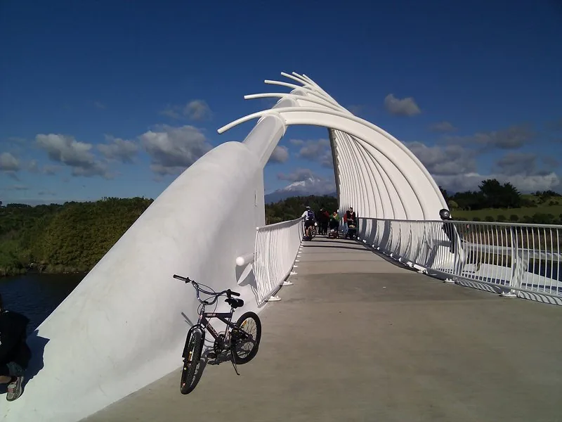
Te Rewa Rewa Bridge — deliberately aligned so the arch frames Taranaki Maunga as you walk away from the burial ground beside it. Photo: Pakaraki, CC BY-SA 3.0 via Wikimedia Commons
New Plymouth's attractions suit a port day, because almost all of them are free and most are outdoors. The decision is a single fork: do you spend the day in the city, on the coast, or commit half of it to getting up the mountain? On a standard call there is not time to do both properly.
In town, on foot (all free)
The Coastal Walkway — 13.2 km of sealed seafront path, flat and shared with cyclists. The central section from Puke Ariki is the obvious walk; bikes are widely available if you want to reach the bridge.
Puke Ariki — museum, library and i-SITE in one building at the shuttle drop-off, open daily 10am–5pm, free to enter all parts of the museum. The Taranaki history galleries are where you understand where you are standing. Free wifi, toilets, lockers, two cafés.
The Wind Wand — 48 m of red fibreglass built to Len Lye's design, erected in 1999, unveiled for the millennium, blown down within the month and reinstated in 2001. It bends and sways in the wind, which in Taranaki means constantly. Lye died in 1980; the wand is his drawing, executed by other hands.
Pukekura Park — 52 hectares of lakes, native bush, fernery and display houses, recognised as a Garden of National Significance. Free, a short uphill walk from the centre.
Fitzroy and East End beaches — black volcanic sand, on the walkway about 3 km from the centre, patrolled by the surf life saving club over summer.
Worth a ride or a booked tour
Te Rewa Rewa Bridge — the 68.8 m white steel arch over the Waiwhakaiho, opened in 2010, designed by Peter Mulqueen and built in agreement with Ngāti Tawhirikura hapū beside a historic burial ground. It is aligned to frame Taranaki Maunga. Free and open; the only question is how you get there.
Egmont National Park / Te Papa-Kura-o-Taranaki — New Zealand's second national park, gazetted in 1900. North Egmont is 29 km / ~30 minutes from the city, with short forest walks from the road end and no entry fee. Parking is limited until December 2026 while the new visitor centre is built.
Govett-Brewster Art Gallery / Len Lye Centre — the national home of Len Lye's kinetic work, at 42 Queen Street, open seven days 10am–5pm. Admission $17 general, $12 seniors and students, free for under-16s.
Surf lessons and coastal tours — a serious, consistent surf coast, with operators running from the beaches directly on the walkway.
If you take one recommendation from me: walk or ride out to Te Rewa Rewa Bridge, and go in the morning. The mountain is far more likely to be clear early, cloud builds through the day, and the bridge is deliberately built to frame it. If the cloud has already won — and it often has — the fallback is a good one: Puke Ariki, the walkway and Pukekura Park will fill a day pleasantly without costing anything.
A note on booking and cost. New Plymouth is an inexpensive port: the walkway, the bridge, Pukekura Park, the beaches and the museum are all free, and the shuttle into town is arranged for you. Only the mountain trips need planning, because the parking constraint at North Egmont is real through 2026 — book ahead and it disappears. A ship excursion costs more than arranging it yourself but comes with a guaranteed return to the vessel, which matters more here than at most stops because you cannot walk back through a secure port. Going independent costs nothing at all: the walkway and the city centre need no arrangement beyond stepping off the shuttle.
History & Heritage
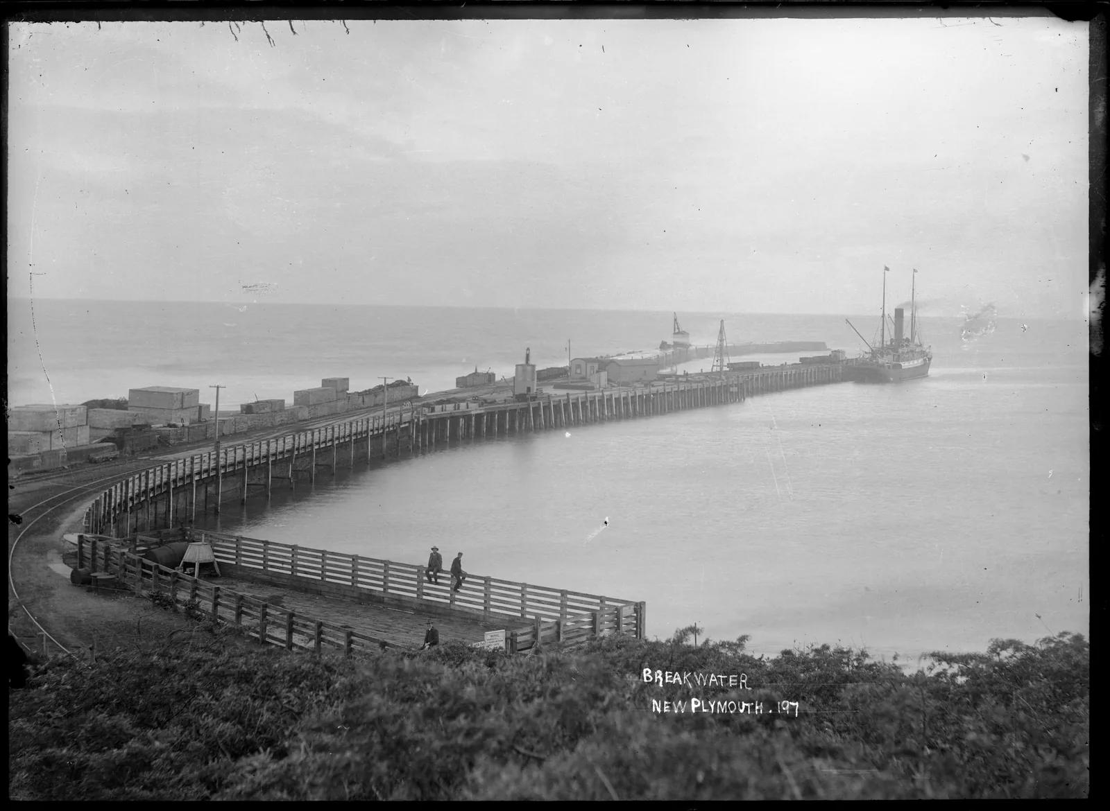
The breakwater about 1910, photographed by William Archer Price. There is no natural harbour on this coast — every sheltered metre of water at Port Taranaki was built. Photo: William Archer Price, via National Library NZ on The Commons, no known copyright restrictions via Wikimedia Commons
Taranaki is where the New Zealand Wars began, and that history is the most important thing a visitor can carry ashore. The New Plymouth area is the rohe of Te Āti Awa, who trace descent from the Tokomaru canoe. European settlement began on 31 March 1841 with the arrival of the William Bryan, on land that had been home to Māori iwi for centuries.
The First Taranaki War ran from 17 March 1860 to 18 March 1861, triggered by the disputed sale of the Pekapeka block at Waitara: a minor chief offered 600 acres, and the paramount chief Wiremu Kīngi Te Rangitāke refused to recognise it. New Plymouth was the centre of the fighting — the town fortified, women and children evacuated to Nelson, three-quarters of the farmhouses in surrounding settlements destroyed. Historians still argue whether it ended in victory, defeat or stalemate; the ceasefire satisfied neither side.
What followed was raupatu — confiscation. Under the New Zealand Settlements Act, land was taken from iwi deemed to be in rebellion; confiscation districts declared across Taranaki in 1865 covered hundreds of thousands of acres, including most of the Te Āti Awa rohe. The Crown has since apologised, and the word to use is confiscation, not purchase.
On that confiscated land, around 1866, Te Whiti o Rongomai and Tohu Kākahi founded Parihaka. By the late 1870s it was, by the accounts of the period, the largest and most prosperous Māori settlement in New Zealand, and its resistance to further survey and settlement was deliberately nonviolent: the Ploughmen of 1879 turning settlers' paddocks to assert title, the Fencers of 1880 blocking surveyed roads. On 5 November 1881, about 1,600 armed troops entered Parihaka at dawn and were met by children singing and skipping and by residents offering food. Te Whiti and Tohu were imprisoned for sixteen months, some 1,600 residents expelled and dispersed without provisions, the settlement looted and largely destroyed. The Crown formally apologised in June 2017.
The arc closes in living memory. In September 2023 the Crown and Ngā Iwi o Taranaki signed the collective redress deed Te Ruruku Pūtakerongo, and on 30 January 2025 Parliament unanimously passed Te Ture Whakatupua mō Te Kāhui Tupua, recognising the mountain and its surrounding peaks as Te Kāhui Tupua, a legal person. The colonial name Mount Egmont was retired in favour of Taranaki Maunga, and on 1 April 2025 Egmont National Park was officially renamed Te Papa-Kura-o-Taranaki. It is the same land fought over at Waitara in 1860, returned to its own name and given standing in law.
Food & Drink Ashore
New Plymouth punches above its size on food, like a lot of provincial New Zealand towns — a compact centre with good coffee, a strong café culture, and restaurants along the waterfront and up Devon Street. The seafood is local and the produce is Taranaki dairy country's own, which is to say the butter and cheese are excellent and unremarked upon locally. Puke Ariki has two cafés, one in the foyer overlooking the walkway — an easy default when the wind gets up.
Practical notes for a port day. The currency is the New Zealand dollar, and New Zealand runs close to cashless — EFTPOS and contactless cards are near-universal, and you can spend a day here without touching cash. Tipping is not customary and not expected: staff are paid a full wage, and declining carries no social awkwardness. And a warning that catches cruise passengers out — New Zealand biosecurity is strict and it applies at the gangway. Fruit, vegetables, honey, most meats and even prepared sandwiches may not be taken ashore. Declare anything you are unsure about; the officers are courteous and the fines are not.
Know Before You Go
You cannot walk off the ship. Port Taranaki is a secure working port; a shuttle across the apron is mandatory. Plan on it rather than around it.
The mountain hides. Taranaki Maunga makes its own weather and is frequently in cloud by mid-morning. If it is clear when you wake up, look at it then.
Biosecurity is serious. No fruit, vegetables, honey or sandwiches ashore. Declare everything; clean your walking shoes if they have been on farmland.
The UV is extreme. New Zealand's summer UV index reaches 12 and above. Sunscreen and a hat matter more here than the mild temperature suggests.
North Egmont parking is constrained until December 2026 while the new visitor centre is built — a booked tour or ship excursion avoids the problem.
Use the mountain's name. It is Taranaki Maunga; the national park is Te Papa-Kura-o-Taranaki. Mount Egmont is a retired colonial name and locals notice.
This call is cancelled more often than most. Port Taranaki is an artificial harbour on an exposed west coast, and swell alone has turned ships away — Seabourn Odyssey in November 2022, Disney Wonder for Tasman seas, Island Princess ahead of Cyclone Gabrielle in February 2023. Book nothing ashore you cannot afford to lose.
Depth Soundings Ashore
Inside the breakwater: moorings, the old power station chimney, and Paritūtū on the skyline. Everything calm in this frame is calm because the wall on the right is doing its job. Photo: Takver, CC BY-SA 2.0 via Wikimedia Commons
The small, specific things that make a New Plymouth day go well — easy to miss until you are standing at the shuttle stop wishing someone had told you:
Look at the mountain first thing. Cloud builds through the day. If Taranaki Maunga is out when you come on deck at breakfast, that is your photograph — do not assume it will still be there at two in the afternoon.
Ride the shuttle out, then walk back in. The trick locals and repeat visitors use: shuttle to the port gates, then walk the 3.4 km of Coastal Walkway into town. You get the seafront approach instead of a bus window.
Hire a bike if the bridge matters to you. Te Rewa Rewa is at the far end of the walkway. On foot it eats the day; on a bike it is a comfortable morning.
Puke Ariki is free, and it is the shuttle stop. Museum, i-SITE, wifi, toilets and coffee in one building at the exact place you are dropped and collected. Start and end there.
The town is not the wet part. New Plymouth averages about 1,409 mm of rain a year; the mountain station records around 7,029 mm. Pack for a breezy coastal town, and pack separately if you are going up.
Cards work everywhere and tips are not expected. You do not need New Zealand cash for a port day, and leaving nothing on the table is completely normal.
Practical Information
Country: New Zealand — North Island, Taranaki region. English is the language; te reo Māori is an official language and place names increasingly use it.
Currency: New Zealand dollar (NZD). EFTPOS and contactless cards are near-universal; cash is rarely necessary.
Tipping: Not customary and not expected. Hospitality staff are paid a full wage. Tour guides may be tipped for exceptional service, but nobody expects it.
Connectivity: Good urban coverage on One NZ, Spark and 2degrees; all three sell tourist eSIMs. Free wifi at Puke Ariki. Coverage thins in the national park's forested valleys. See our internet at sea guide for onboard options.
Time zone: New Zealand Standard Time (UTC+12), or NZDT (UTC+13) during the southern summer — which includes the February–March cruise season.
Biosecurity: Strict, and enforced on cruise passengers going ashore. Fruit, vegetables, honey, most meats and prepared food may not be landed. Declare items rather than risk an instant fine.
Safety: New Plymouth is a small, safe provincial city. The genuine cautions are environmental — extreme UV, strong sun, a powerful surf coast with rips, and mountain weather that changes fast.
New Plymouth Photo Gallery
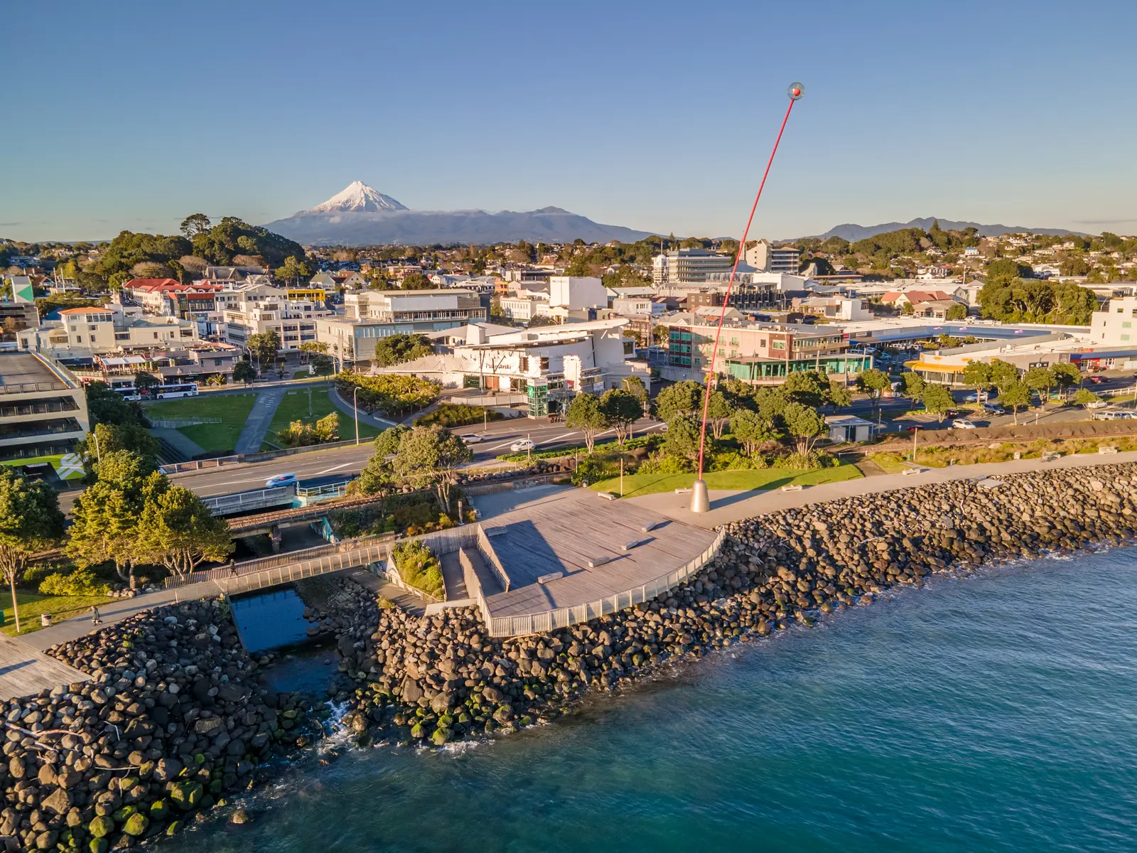
The whole port day in one frame: the Wind Wand, Puke Ariki, the walkway and the mountain. Photo: Mknz24, CC BY-SA 4.0 via Wikimedia Commons
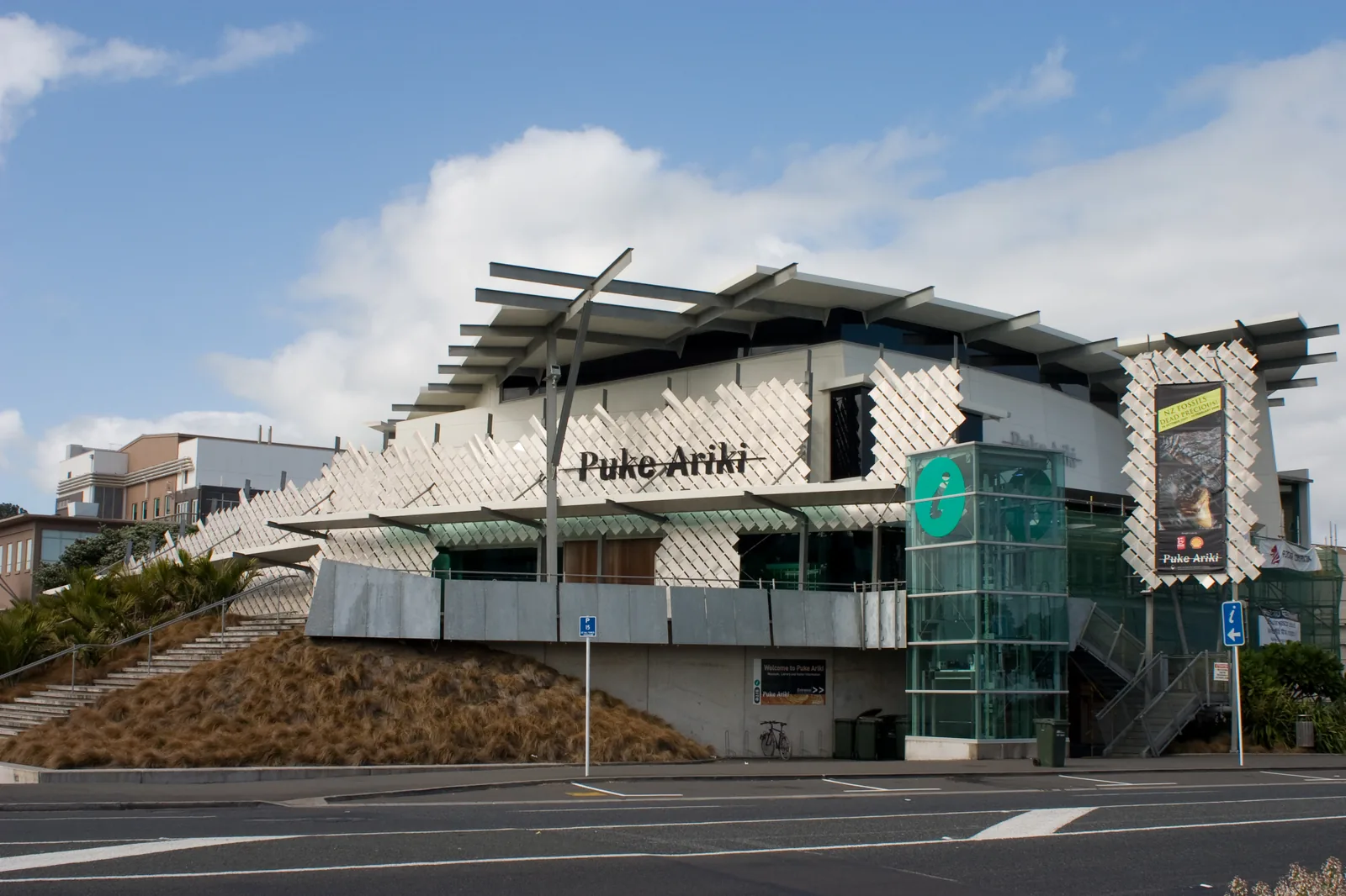
Puke Ariki — museum, library and i-SITE in one building, and the cruise shuttle drop-off point. Free to enter. Photo: Aidan, CC BY 2.0 via Wikimedia Commons
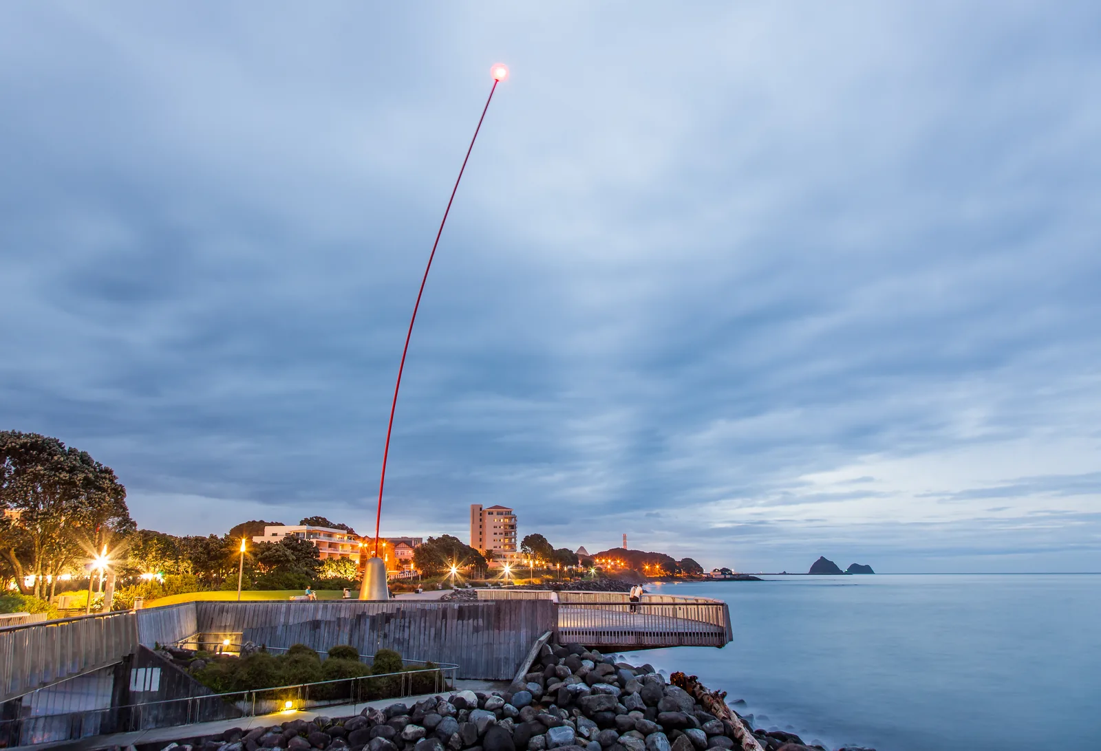
The Wind Wand at dusk, its sphere lit. Forty-eight metres of red fibreglass, built to Len Lye's design and bending — as designed — in the wind. Photo: russellstreet, CC BY-SA 2.0 via Wikimedia Commons
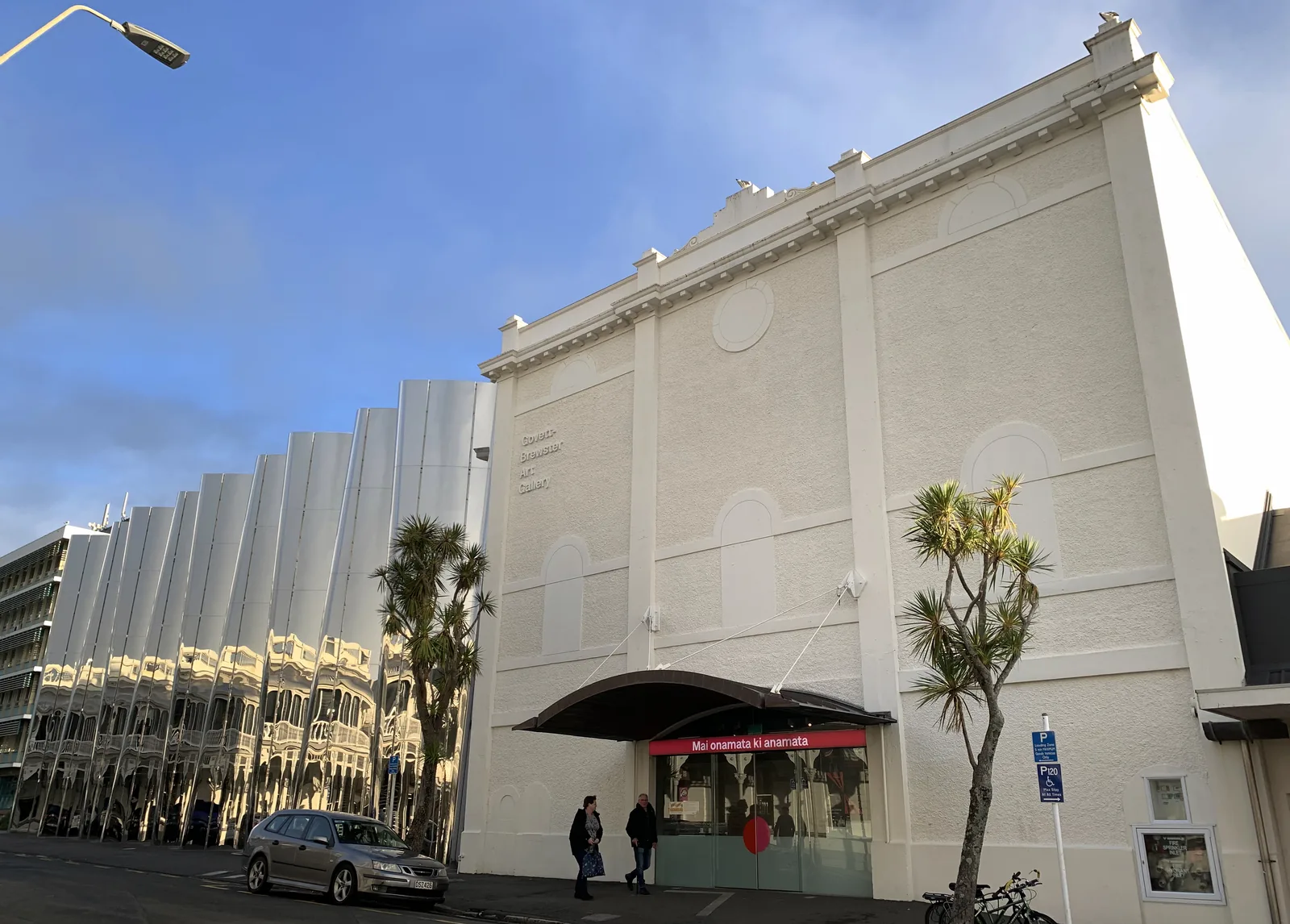
The Len Lye Centre's mirrored columns on Queen Street, reflecting the older street back at itself. Photo: Tom Ackroyd, CC0 via Wikimedia Commons
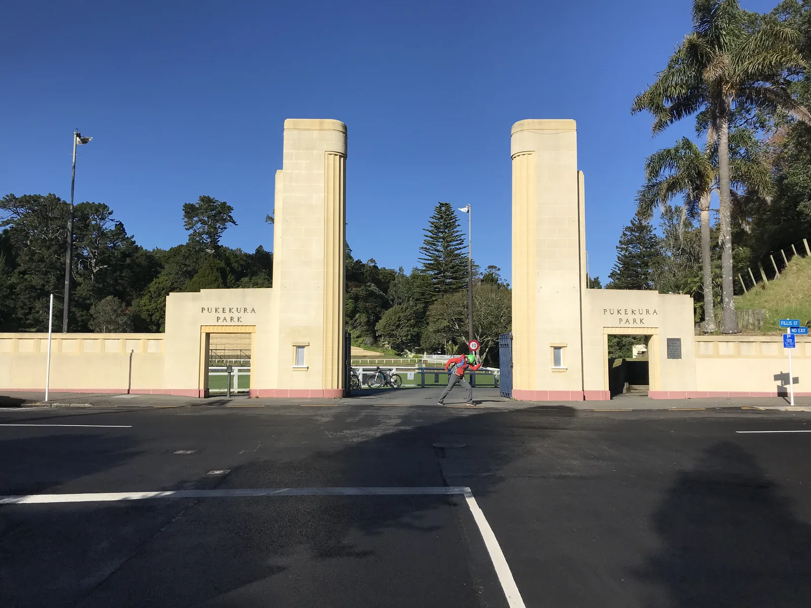
The Art Deco entrance pylons to Pukekura Park. The garden itself is through the gate and downhill. Photo: Schwede66, CC BY-SA 4.0 via Wikimedia Commons
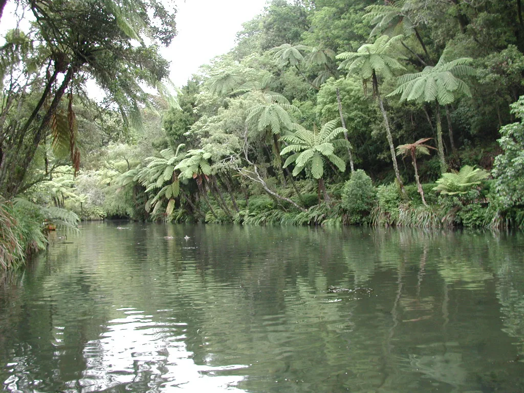
The main lake at Pukekura Park, ringed by tree ferns — 52 hectares a short walk uphill from the city centre. Photo: Pseudopanax, public domain via Wikimedia Commons
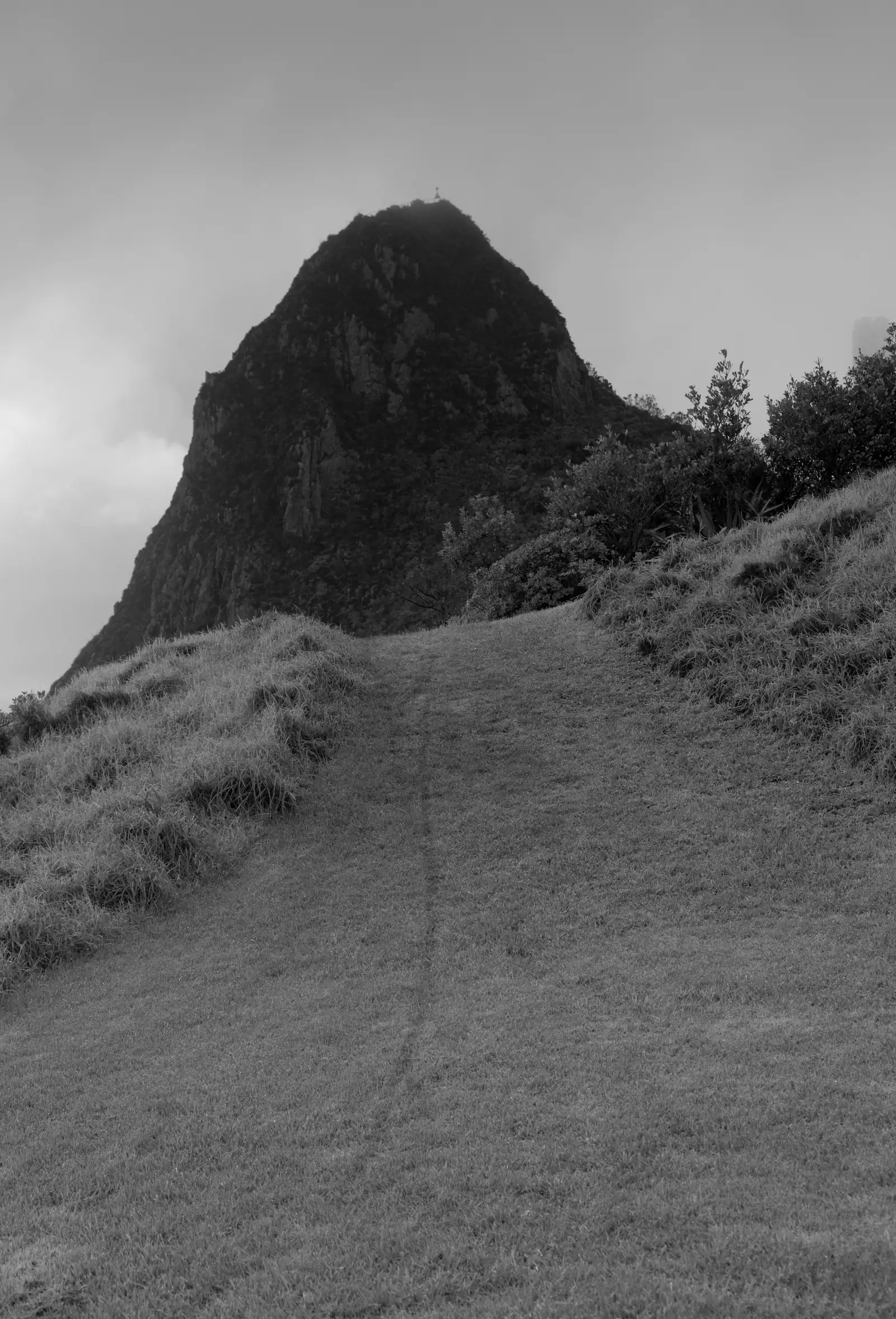
Paritūtū, with someone on the summit for scale. The last stretch up is a chain-assisted scramble on steep eroded rock, not a walk. Photo: russellstreet, CC BY-SA 2.0 via Wikimedia Commons
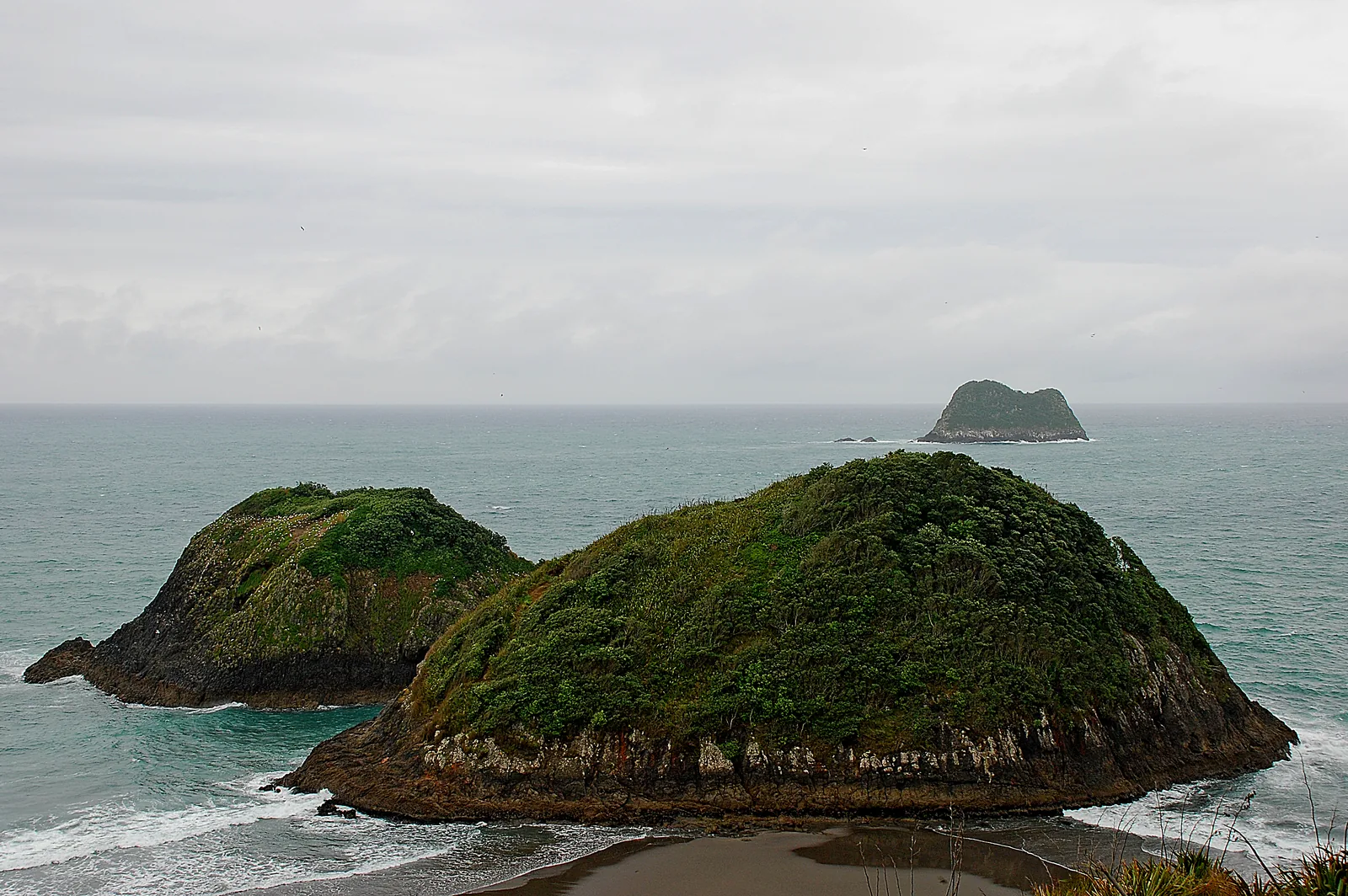
Ngā Motu, the Sugar Loaf Islands — eroded volcanic stacks in a marine protected area, and the first thing you see on the approach. Photo: Phillip Capper, CC BY 2.0 via Wikimedia Commons
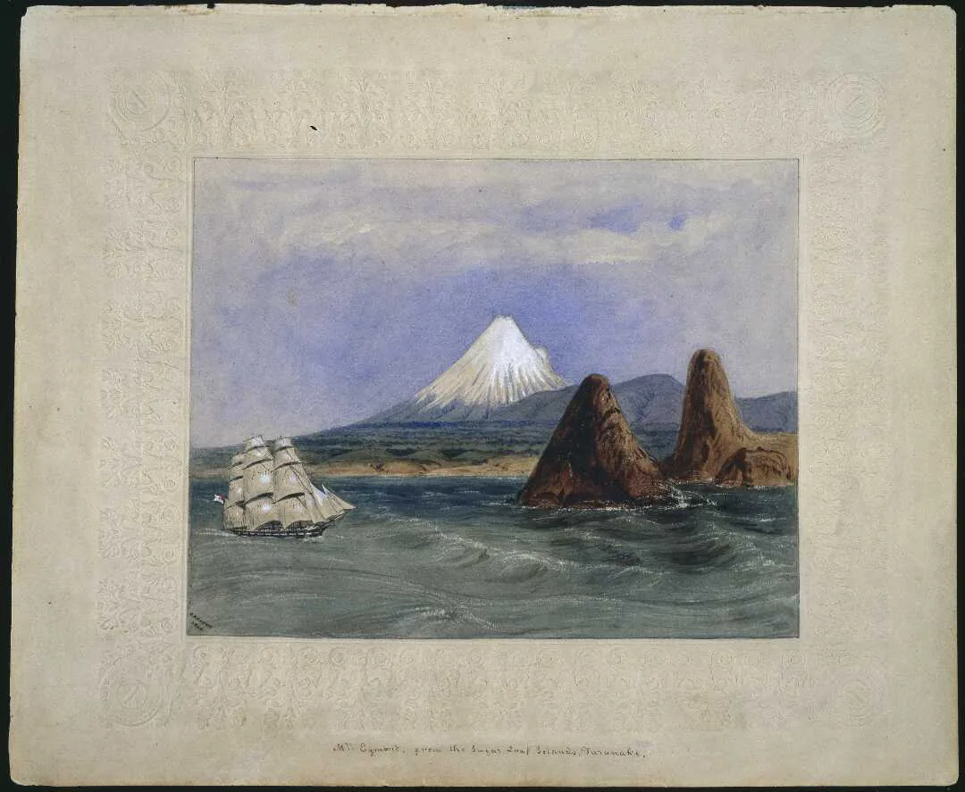
Charles Heaphy, about 1849: the mountain from the Sugar Loaf Islands, under sail. The view your ship still gets on the way in, minus the port. Photo: Charles Heaphy, public domain via Wikimedia Commons
Credits
Every image on this page comes from Wikimedia Commons under the license noted and is credited to its creator below. In the Wake does not claim authorship of these images; when we can add our own photographs from a future visit, we will.
Taranaki Maunga over New Plymouth (page header image) — Itineris55, CC BY-SA 4.0
The honest version of the view: Taranaki Maunga is directly behind this cloud, and on many — Takver, CC BY-SA 2.0
Port Taranaki from Paritūtū — russellstreet, CC BY-SA 2.0
The reason the boundary is startling: a 9 — NASA Earth Observatory image by Wanmei Liang, using Landsat data from the U.S. Geological Survey, public domain
The breakwater about 1910, photographed by William Archer Price — William Archer Price, via National Library NZ on The Commons, no known copyright restrictions
Inside the breakwater: moorings, the old power station chimney, and Paritūtū on the skylin — Takver, CC BY-SA 2.0
The whole port day in one frame: the Wind Wand, Puke Ariki, the walkway and the mountain — Mknz24, CC BY-SA 4.0
The Wind Wand at dusk, its sphere lit — russellstreet, CC BY-SA 2.0
The Len Lye Centre's mirrored columns on Queen Street, reflecting the older street back at — Tom Ackroyd, CC0
The Art Deco entrance pylons to Pukekura Park — Schwede66, CC BY-SA 4.0
The main lake at Pukekura Park, ringed by tree ferns — Pseudopanax, public domain
Paritūtū, with someone on the summit for scale — russellstreet, CC BY-SA 2.0
Ngā Motu, the Sugar Loaf Islands — Phillip Capper, CC BY 2.0
Charles Heaphy, about 1849: the mountain from the Sugar Loaf Islands, under sail — Charles Heaphy, public domain
Frequently Asked Questions
What is the best time of year to visit New Plymouth?
The New Zealand cruise season runs roughly November through April; February and March are the sweet spot — settled late summer, mean highs around 21–22°C, long evenings. Winter is cold, wet and windy, not a cruise window at all. Whatever month you call, the mountain is most likely to be clear early in the morning.
What should I pack for New Plymouth's weather?
Layers and a genuine wind shell: Taranaki is one of New Zealand's windiest regions and the westerly is near-constant. Serious sun protection too — New Zealand's summer UV index reaches 12 and above even on mild days. Comfortable walking shoes for the Coastal Walkway, and a rain jacket for the national park, where the weather is a different animal entirely.
Will rain ruin my New Plymouth port day?
Rarely. The town is not especially wet: New Plymouth averages about 1,409 mm a year across roughly 8–9 wet days in February and March, unremarkable for coastal New Zealand. The extraordinary rainfall belongs to the mountain, where the North Egmont station records around 7,029 mm. On a grey day Puke Ariki and the Govett-Brewster are indoors and worth real time, and the sealed walkway is pleasant under a shell.
Can I walk off the ship in New Plymouth?
No. Port Taranaki is a secure working commercial port, and the New Zealand Cruise Association's port information states plainly that passengers cannot walk off the port; a shuttle takes you across the working area. Outside the gates you can walk, and many people ride to the gate and then walk the 3.4 km of Coastal Walkway into the city — about 30 minutes on a flat sealed path.
Will I actually see Mount Taranaki?
Maybe — mornings are your best chance. Taranaki Maunga makes its own weather: New Plymouth gets more than 2,000 hours of sunshine a year while the summit gets under 1,750, and cloud typically builds through the day. If it is clear when you come on deck at breakfast, take your photograph then rather than trusting the afternoon.
Why is the mountain called Taranaki Maunga and not Mount Egmont?
Because that is its name. The colonial name Mount Egmont was retired in the 2025 Treaty settlement, and the national park was officially renamed Te Papa-Kura-o-Taranaki on 1 April 2025. In January 2025 New Zealand's Parliament unanimously passed legislation recognising the mountain and its surrounding peaks as Te Kāhui Tupua — a legal person with the rights, powers, duties and liabilities of a person. Locals use the correct name; so should visitors.
Can I get to Egmont National Park on a port day?
Yes, with planning. The North Egmont road end is 29 km from the city, about a 30-minute drive, and the realistic option on a typical 08:00–15:00 call. Dawson Falls on the southern side is roughly an hour each way — a tight round trip. Parking at North Egmont is limited until December 2026 while a new visitor centre is built, so a booked tour or ship excursion is the low-friction choice.
What is Te Rewa Rewa Bridge and why does it matter?
It is a 68.8 m white steel footbridge over the Waiwhakaiho River, opened in 2010, at the eastern end of the Coastal Walkway. It matters for how it was built: beside a historic burial ground at a former pā, made possible by agreement with Ngāti Tawhirikura hapū, designed to touch lightly on that bank out of respect, and deliberately aligned so the arch frames Taranaki Maunga as you walk away from the graves.
How much does a day in New Plymouth cost?
Very little. The Coastal Walkway, Te Rewa Rewa Bridge, Pukekura Park and the beaches are free, and Puke Ariki museum is free to enter in all its parts. The Govett-Brewster Art Gallery and Len Lye Centre charges $17 general admission, $12 for seniors and students, nothing for under-16s. The main costs are transport to the mountain and any bike hire.
Do I need to tip in New Zealand?
No. Tipping is not customary and not expected: hospitality staff are paid a full wage rather than relying on gratuities, and most New Zealanders regard tipping as something visitors do. Leaving nothing carries no awkwardness. For genuinely exceptional service 10 per cent is generous, and tour guides are the one area where it is a little more common.
How strict is New Zealand biosecurity for cruise passengers?
Strict, and it applies going ashore, not just on first arrival in the country. Fruit and vegetables may not be taken ashore, nor most meats, honey, flowers, seeds or prepared meals — including sandwiches from the ship's buffet. Anything made of plants or wood, and any used outdoor equipment, can carry pests. Declare rather than risk it: officers are courteous, and instant fines for undeclared items are real.
Is New Plymouth accessible for limited mobility?
Reasonably, in town. The shuttle is step-free at the gangway in normal conditions, and the Coastal Walkway is flat, sealed and among the more wheelchair-friendly waterfront paths in New Zealand. Puke Ariki is fully accessible and rents wheelchairs. The mountain is harder — steep access roads, uneven natural ground, fast-changing weather — so treat Egmont National Park as a separate decision from the town.
Does New Plymouth have a storm season, and can the call be cancelled?
New Zealand sits outside the tropical cyclone belt, but ex-tropical cyclones track down over the North Island between roughly December and April, and Taranaki takes westerly gales year-round. Port Taranaki is an artificial harbour on an open, exposed coast, and calls here are cancelled more often than at sheltered ports: the port's own news records Seabourn Odyssey turned away by swell in November 2022, Island Princess cancelled ahead of Cyclone Gabrielle in February 2023, and Disney Wonder cancelled for high seas in the Tasman. Treat this as a call that may not happen, and do not book anything ashore you cannot lose.



_from_New_Plymouth_(NZ).jpg)
_(7087585151).jpg)

.jpg)


.jpg)


